| |
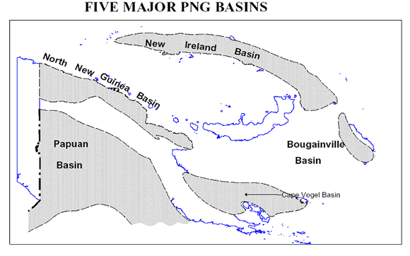
Papua
New Guinea has five major sedimentary basins. Of these,
the Papuan Basin has the highest number of wells drilled.
The Papuan basin to date has 278 wells drilled. The success
rate is quite high in terms of oil and gas exploration.
The other sedimentary basins are quite prolific too and
comprised of North New Guinea which has 21 wells drilled,
Cape Vogel Basin has 5 wells drilled, Bougainville Basin
has 1 well, and New Ireland Basin has yet to have a well
drilled. |
| |
|
| |
|
| |
Location map of the five major sedimentary basins in
Papua New Guinea
|
| |
|
| |
|
| |
|
| |
Papuan
Basin - exploration & development hotspot |
| |
|
| |
Exploration
efforts in PNG are often made difficult due to the extreme
physiographic and geologic geometry of the Papuan fold
and thrust belt. However, the discoveries made so far
contain prolific Cretaceous sand reservoirs. The reservoirs
have excellent sand quality, good porosity and extremely
high permeability. Development wells have high productivity
indexes and each well is capable of producing 10,000 bbls
of oil per day. |
| |
|
| |
Of
the five major basins in PNG, the Papuan Basin is the
current hotspot where most of the petroleum exploration
and development work is taking place. The four main rock
units that are of interest to exploration drilling and
development are; the Darai, Ieru, Toro and Imburu Formations.
|
| |
|
| |
The
Darai Limestone is a karsted marine shelf carbonate of
Miocene age, highly fractured and varying in thickness
from 3000 ft to 5000 ft. The Ieru Formation is a shaly
unit which underlays the Darai Limestone and is of the
Upper Cretaceous age. It is divided into upper and lower
units. Upper Ieru is mainly sandstone and the lower Ieru
section is composed of three distinct members; the Bawia,
Juha, and Alene members. |
| |
|
| |
The
Toro sandstone underlays the Ieru Formation and is of
Lower Cretaceous age. It is the primary reservoir unit
in Kutubu and Moran Project oil fields. Toro sandstone
formation comprise of Toro A, Toro B and Toro C members.
Toro is a clean fine to medium grained quartzitic, marine
sandstone. The sands become coarser and more angular as
you go from Toro A to Toro C. Thickness of the Toro is
about 300 - 400 ft. Permeability can reach up to 2 Darcies
and an average porosity of about 15%. |
| |
|
| |
The
Imburu Formation composed of the Upper Jurassic Digimu,
Hedinia and Iagifu members. The Digimu member is similar
in composition to Toro and in most places is 100 ft thick
and has an average porosity of 13%. Fluid gradients observed
in Toro and Digimu reservoirs are 0.063 psi/ft for gas,
0.29 psi/ft for oil, and 0.43 psi/ft for water. Pressures
range from 2000 - 2800 psia. The Digimu member is a secondary
reservoir unit in the Kutubu and Moran fields. |
| |
|
| |
The
Hedinia and Iagifu members of the Imburu are older than
the Digimu. In Gobe and SE Gobe fields, Iagifu sandstone
is the primary reservoir. The Iagifu is overlain by a
mudstone section of Imburu and is approximately 120 to
160 ft thick, and has porosities ranging from 10 - 23%
with permeabilities up to 11 Darcies. |
|
|
| |
|
| |
|
| |
Geophysics
|
|
|
| |
|
| |
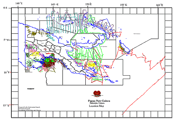
Seismic lines location map of Papua New Guinea
|
| |
|
| |
|
| |
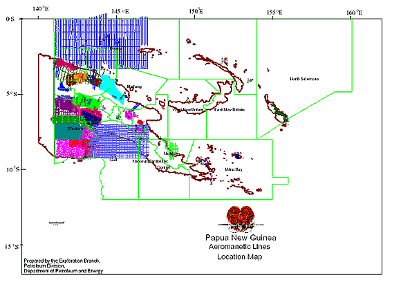
Aeromagnetic lines location map of Papua New Guinea
|
| |
|
| |
|
| |
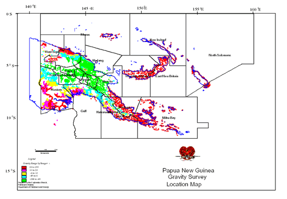
Gravity survey location map of Papua New Guinea
|
| |
|
| |
|
| |
|